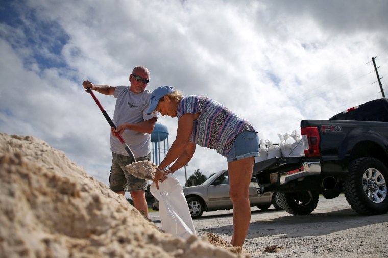
The northern Gulf Coast was getting hit early Tuesday by slow-moving Hurricane Sally's outer bands, which arrived with the threat of strong winds, life-threatening storm surge and flash flooding.
The storm strengthened earlier Monday to a category 2 hurricane and made its way across the Gulf of Mexico toward Mississippi and Alabama with 100-mph sustained winds. Sally is expected to make landfall late Tuesday or Wednesday.
Hurricane warnings stretched from Grand Isle, Louisiana, to Navarre, Florida, but forecasters — while stressing “significant” uncertainty — kept nudging the predicted track to the east.
That eased fears in New Orleans, which once was in the storm’s crosshairs.
Sally's slow speed prompted worries that the storm would stall out over land, dumping lots of water and flooding coastal communities.
Alabama Gov. Kay Ivey ordered the state's beaches to close Monday afternoon in preparation for the storm.
"I urge everyone to tune in to their trusted weather source, and pay attention to your local officials for updates regarding your area as they make further recommendations based off the unique needs of your community," Ivey said.
The storm's maximum sustained winds of 100 mph are expected to grow stronger overnight Monday, the National Hurricane Center said.
Gov. John Bel Edwards declared a state of emergency Saturday. On Monday, the Hurricane Warning area included metropolitan New Orleans, Lake Pontchartrain and Lake Maurepas.
“While we ultimately don't know where Sally will make landfall, much of Southeast Louisiana is in the storm's cone and the risk of tropical storm force or hurricane strength winds continues to increase," Edwards said in a statement. “This storm has the potential to be very serious.”
President Donald Trump on Monday night approved an emergency declaration for Alabama, which authorizes federal assistance, due to the hurricane. The president has also approved emergency declarations for Mississippi and Louisiana.
Louisiana is still reeling from Hurricane Laura, which hit in late August as a Category 4 storm and destroyed much of Lake Charles. Electric services remain “severely limited” in much of the city, which is also under a boil advisory for water.
Tennessee authorities sent 35 members of various agencies to Louisiana to offer support to the weather battered state, including employees of the Metro Nashville Office of Emergency Management and Nashville Fire Department. Texas Gov. Greg Abbott also sent dozens of search and rescue personnel and boats to the state.
Sally is not expected to bring as intense surges and winds as Laura, but at the mouth of the Mississippi River, storm surge levels, which vary based on the tidal cycles, could reach as high as 11 feet.
On Monday night, the storm was 100 miles east of the Mississippi River and 135 miles southeast of Biloxi, Mississippi, the National Hurricane Center said. Sally was moving at 5 mph, the center said.
During a news conference earlier, Mississippi Gov. Tate Reeves said that although the forecast track for Sally had shifted east slightly, storm surge projections still topped nine feet for one coastal county and as much as 20 inches of rain could present "significant water challenges."
"It is still anticipated that we will bear the brunt of this storm," he said.

In Mobile, Alabama, Ashley McGee Flores, 33, filled up her gas tank Monday and drove with her two young children to her sister's home 20 minutes inland. Though she doesn't live in an evacuation zone, she made the decision to leave after learning that the storm shifted.
Hurricanes are "literally part of our life," she said in an interview Monday. "I just think people should have the mind-set of, 'I'd rather overprepare and it not be as bad as for us,' than to be underprepared and suffer the consequences of that.”
In the town of Mandeville, Louisiana, 35 miles north of New Orleans, Chris Yandle was cleaning a ditch in the front yard, filling his cars with gas and tying patio furniture together before evacuating with his family.
Download the NBC News app for breaking news
Even though the shift in the hurricane's track suggested that the region may avoid a direct hit, he said, the storm's movement had made him even more frantic.
"You think, ‘Oh it’s not coming this way,’ and all of a sudden, four hours later, it has changed course," said Yandle, 38, a native of the area who's experienced other powerful hurricanes to hit Louisiana.
“For whatever reason, this storm is probably the most anxious I’ve ever been,” said Yandle, adding: "It’s 2020. What other event can possibly happen that we haven’t gotten yet?"
In New Orleans, meanwhile, officials were also preparing for the storm. Mayor LaToya Cantrell said Monday that it was good news that the storm had shifted, but the water in some canals had still been drained to prepare for a downpour and all of the city's 99 drainage pumps were operational.
"It can again easily move back," she said. "Forecasts are not certain where the landfall will be, but it is definitely in the path of the city of New Orleans."
